Boston Fort Point Masterplan
Masterplanned a 10-acre downtown Boston site to Barcelona density with 40% open space.
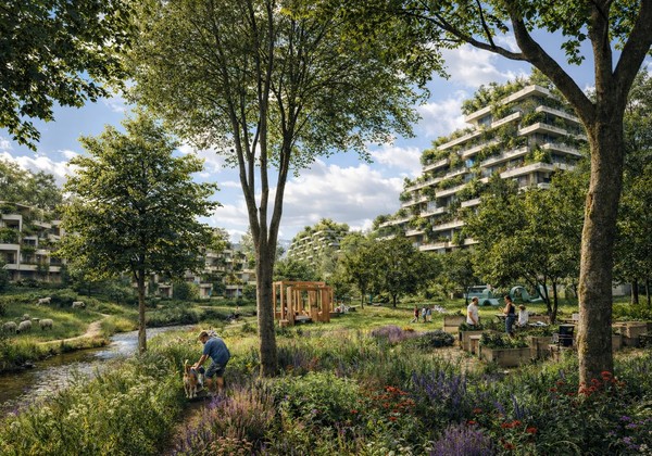
Fort Point is a 10-acre site in downtown Boston beside the central business district and the Diller Scofidio + Renfro Institute of Contemporary Art, at the time occupied largely by parking lots. Except developed a workable process for sustainable decisions about density, demographics, logistics and environmental quality, then applied it here. The plan shifts the programme toward residential with retail and offices, targets a floor area ratio near 9, holds at least 20% of the site as open space, and restricts car access to emergency and supply traffic.
The Problem
A sustainable city is livable, identifiable and made by the people in it, which means it must answer to local climate, culture and operations. A generic sustainable solution is an abstraction. A methodology only earns its keep when it survives contact with a real site.
Boston supplied the constraints. The city centre holds roughly 240,000 jobs against 27,000 residents, so a large share of transport energy is spent commuting people into a district they cannot live in. Traffic accounts for about a third of US energy use, and roughly 70% of that goes to inefficient private car use. Set against Copenhagen, Boston's car use is far higher and its commutes considerably longer.
Process
Raise density to a livable target
Residential energy falls fastest with density, measured as floor area ratio. The reference is Barcelona at roughly 9. Sparse high-rise or dense low-rise both reach it; the plan combines them for a more diverse and flexible arrangement, and keeps building heights low so sunlight reaches the streets and the neighbourhood holds a human scale.
Give the land back as open space
A quality urban environment needs a minimum of 20% open space, and preferably up to 40%. Eliminating cross streets and covering the large thoroughfare recovers the land to pay for it. Open spaces are arranged at the knuckles of the pedestrian routes, tying into the existing harbour walk and the surrounding places of cultural interest.
Move the infrastructure underground
Retail, transport lines and related hubs are placed below grade, along with the energy hub for collection and generation. Ground level is left for open space, cycling, restaurants and entertainment. Car access is limited to emergency and supply traffic, an additional subway line merges with the existing under-used Blue Line, and truck routes stay as they are.
Outcomes
- Target floor area ratio
- 9
- Matching Barcelona, reached by mixing high-rise and dense low-rise.
- Open space
- 20 to 40%
- Recovered by removing cross streets and covering the thoroughfare.
- Site area
- 10 acres
- Downtown Boston, beside the central business district.
Gallery
Credits
Except team: Tom Bosschaert (Director).
Except team: Tom Bosschaert (Director).
More urban planning
Working on something with this shape?
We take commissions where systemic complexity is the central design challenge. Tell us about the place, the constraint, or the problem.